Making Sense of Document Collections with Map-Based Visualizations
Book (Dissertation)
Buchel, O & Sedig, K (2014). Making sense of document collections with map-based visualizations: Role of interaction. Journal of Information Research.
This research looks at Knowledge Organization Systems (KOS) such as metadata and classification and special instance of graphical representations. Georeferences in KOS.
Each object has its own ontological properties. For instance, the ontological properties of a document may include its author, title, publisher, height, number of pages, illustrative matter, indexical information, publication language, subject, edition information, and publication date.
Different ways to represent ontological properties:
Digital Maps
ThemeScape
Kohonen Map
Tree Map
Topic Map
Flickr-Style Tag Cloud
Cartogram
Fisheye View
Hyperbolic Tree
Maps can help users understand what locations are represented in collections, what is their density, how big are geographical distances among collections, how collections are distributed in space and time.
Extending Map-Based Visualizations to Support Visual Tasks: The Role of Ontological Properties
VICOLOEX (Visual Collection Explorer)
Throughout this paper, we have drawn attention to two research issues concerning map-based visualizations. The first research issue is the need to extend map-based visualizations to include representations that encode ontological properties of documents. The proposed representations in our prototype are not necessarily the most usable, effective, or efficient representations of ontological properties. Testing is underway to determine effectiveness of these representations. The second research issue, tightly coupled with the first, is the need to take into consideration visual tasks that can be supported by visual representations.
Making Sense of Document Collections with Map- Based Visualizations: The Role of Interaction
Types of Map Based Visualizaitons
Simple MBV (users submit queries in search box and retrieve result displayed on map)
Space time topic centered MBV (focus on visualization of time space and topics or themes of a given collection.
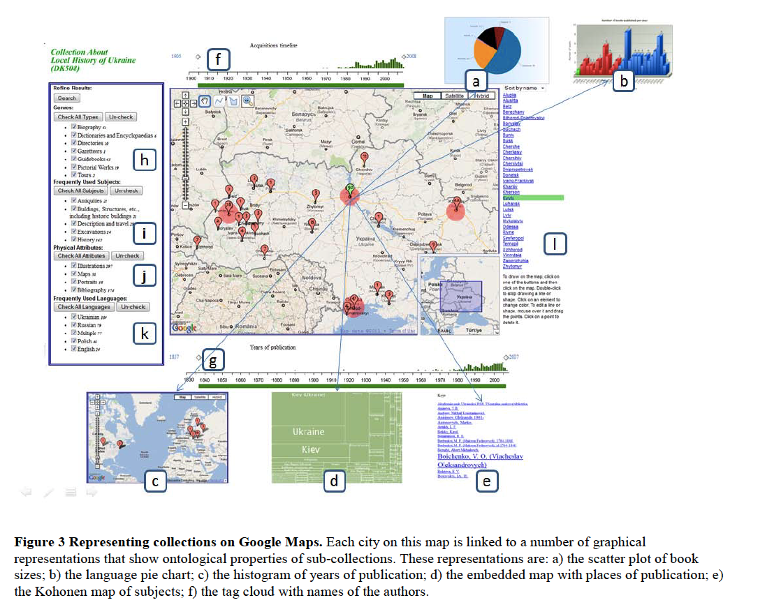
Complex MBV (make salient a greater number of ontological properties of collectiosn than space time topic centered... ontological properties of documents linked to each location are represented with additional representations
Activities, Tasks, and Interactions
An interaction is a low level action that users perform on representations followed by the response they get (Sedig, 2009)
Tasks are conscious, goal related processes that must be undertaken to fulfill a goal and can be decomposed of subtasks. To perform tasks, users act upon representations in MBV.
Activities are undertaken by human subjects motivated towards objects producing outcomes and mediated by tools and environments
Sensemaking
Sensemakign activities are usually characterized as ill structured, open ended problems. For example, exploring the genealogy of family history, tracing history of remote places, and gathering information about places of interest for trips are sensemaking activities.
Collection understanding involves encountering a collection and learning about its structure, its theme, its properties, why certain documents belong to it, common features of its documents, and varying qualities linking these documents.
Information spaces associated with document collections
semantic
geographic
social
working
Uses EDIFICE actions form (Sedig and Parsons)
Development of VICOLEX
Can Additional Representations in Map-based Visualizations Enhance Sensemaking Activities Such as Collection Understanding
Our evaluation study poses the following research questions:
1. Can the proposed representations help novice users understand collections?
2. If yes, how are these representations useful? What do they mean to the users?
3. Do the representations need to be improved? If so, how?
We investigated these questions by conducting a qualitative exploratory study.
13 person focus group put through the following phases: demonstration, think aloud protocol, interview and questionnaire.
Findings: Pie charts informed participants of the languages in the collections. Colour-coded histograms of years of publication helped users understand the history of disciplines as well as social, economic, and historical changes in locations. KMs helped users understand some trends in subjects in the collections of different locations. Embedded maps of places of publication helped users identify the locations of publishers, authors, and collaborators, and learn something about the flow of immigration. The tag clouds of author lists informed users about the most prolific authors in the collection.
